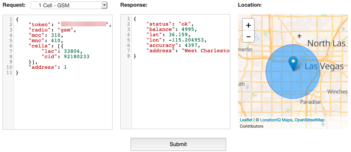
When there is no Google Earth or Street View, what can you do?
When doing investigations in countries other than the one you reside in, it can be helpful to have social media to give you a view of what a certain place can look like. Although we can rely on tools like Google Earth, Bing’s Birds Eye View, Sentinel Hub and others to give us satellite imagery or street view, you can run into locations where there … Continue reading When there is no Google Earth or Street View, what can you do?