Maritime OSINT may seem elusive and difficult to work into your everyday OSINT analysis but I assure you there is value there. Maritime is not just supply chain- it is also human targeting, corporate recon, geospatial intelligence, signals intelligence, international relations, and so much more! In this blog, I give my top 5 Maritime OSINT tips that will hopefully help you dip your toe in the water to see what new angles this could add to your analysis.
- 1. Gather Geographical Context
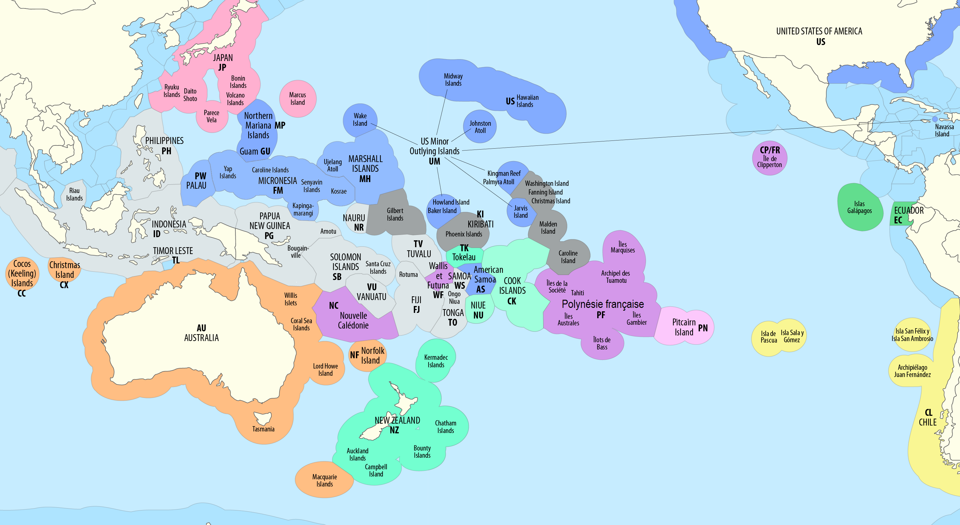
The sea is not only vast and expansive but integral for a large percentage of product shipment (which equals lots of money). Because of the amount of product moved by sea, through canals and exclusive economic zones, there is lots of historical and geographical nuance that we need to understand before we can interpret movements. For instance, if we were unfamiliar with China’s “Nine-dash Line,” a territorial claim over the South China Sea, we might not understand why a ship would take a certain path through the area. Gathering geographical context is the first step to fully understanding the movements and interactions of the vessels we analyze. I will sometimes watch documentaries and listen to podcasts about specific regions that I know I will be conducting a lot of research in.
- 2. Track the Vessel
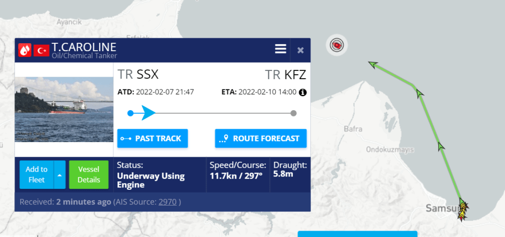
I won’t lie, tracking a vessel can be difficult using freely available open-source tools. Vessels above 300 tons are requires to have AIS (Automatic Identification System) on the vessel. AIS sends out a signal identifying and showing where a ship is along with some extra details like draft, speed, destination, and port calls. There are a few well-known tools for tracking AIS such as marinetraffic.com or vesselfinder.com, unfortunately we can only see the current path and we don’t have access to any historical data without a paid account. The free versions of these tools are best suited for events happening in real-time versus comparing movements historically. Think of the Ever Given Suez Canal disaster…
3. Gather situational context
Once we find a vessel to track and we understand the historical context of the area we need to gather the situational context. It is important to keep a few things in mind at this point. Not everything is an indication of nefarious activity (it could be something simple like weather), AIS can be manipulated, and AIS is just one source so we need to confirm findings with satellite imagery or other sources. When looking for situational context there are a few questions we can ask ourselves:
- Do we see any vessels meeting with our vessel? Did it need to refuel or transfer goods?
- Is the vessel displaying a pattern? Is it scanning the ocean floor, drifting, circling?
- Do we notice any strange changes to the vessel’s identity over time?
- Is the vessel part of a military exercise or used for military purposes?
- Is the vessel acting in uneconomical way? Doing something that wouldn’t make them money?
- 4. Don’t forget about Social Media
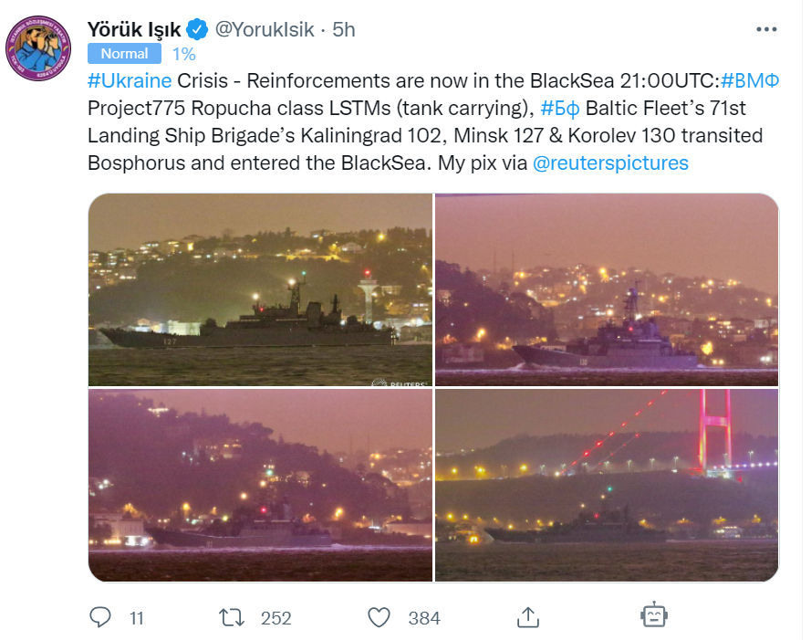
A great way to keep track of vessels without paying for expensive tools is through Social Media! There are many people who upload photos, videos, IMO numbers, and details about vessels to Twitter. Depending on the area of the world I am researching I will curate a Tweet Deck of researchers for that region in order to keep up with current events and movements. If it is military vessels you are after, many of these vessels have their own social media pages that post regular updates during an exercise. It is also good to remember that a vessel is full of people who are not necessarily as careful on social media as one would think. It is pretty easy to find full walkthrough tours on Youtube for specific vessels.
- 5. Always do Company and Sanctions Research
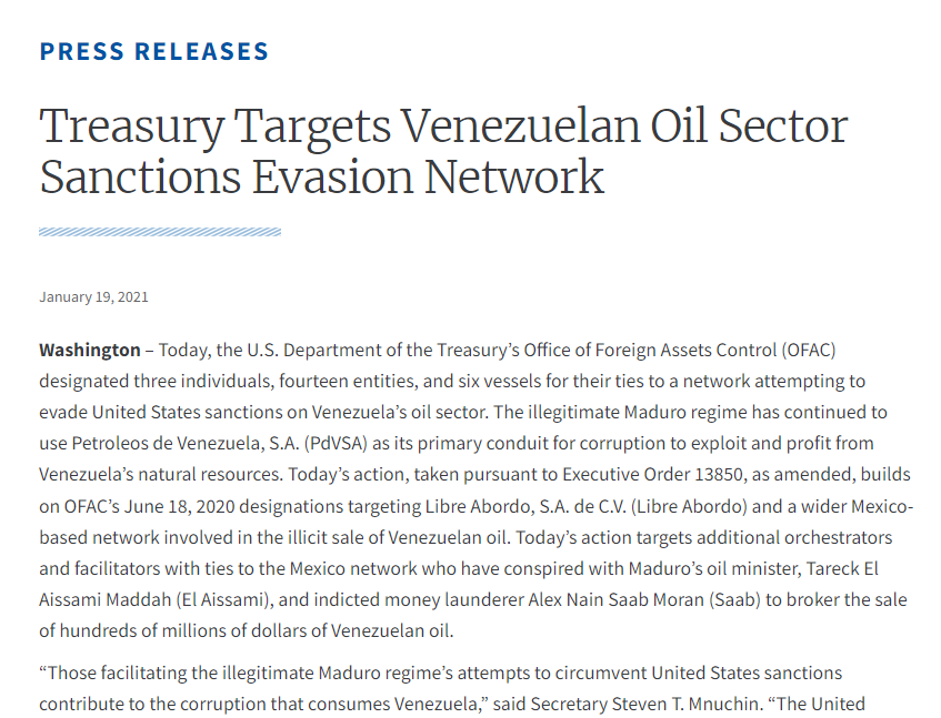
Vessels are often owned, operated, and repaired by various different companies. A surprising amount of maritime companies are shell companies used to hide the true owners of the vessel. We can investigate these companies the same way we would any company using OSINT. Sometimes we can find emails for the vessel itself or determine that somewhere in the chain of ownership a company has been sanctioned by OFAC (Office of Foreign Asset Control). We can look up the individual sanctions by searching on the Treasury Department website for the vessel name, company, or personnel to find further details on why they were sanctioned. OFAC tends to sanction one entity and then perform a cascade of sanctions down through all the subsidiaries, people, and vessels associated.
Hopefully, these 5 tips helped spark an idea that you can implement in your daily investigations. For more maritime-related content, please follow me on Medium!